Wednesday, October 24, 2018

Wed & Thursday Oct 23rd & 24th Days 45 & 46

Mapping and Explorers- Day 4


Objective(s):
1. The advantages of coordinating multiple geographic representations—such as maps, globes, graphs, diagrams, aerial and other photographs, remotely sensed images, and geographic visualizations to answer geographic questions
Therefore, the student is able to:
A. Explain the advantages of using multiple geographic representations to answer geographic questions, as exemplified by being able to
  • Explain how multiple geographic representations and geospatial technologies (e.g., GIS, GPS, RS, and geographic visualization) could be used to solve geographic problems (e.g., help determine where to locate a new playground, or identify dangerous street intersections within a community).
  • Describe how an analysis of urbanization can be done using differ­ent geospatial technologies (e.g., RS for land use, GIS data layers to predict areas of high/low growth, GPS and GIS for identifying trans­portation issues regarding growth).
  • Explain how multiple geospatial technologies can be used to solve land-use problems (e.g., effects of new farming technologies on the sustainable production of food, preservation of wetlands in bird mi­gration flyways).
Rationale: Understanding how maps were created and used allows students to understand the history of exploration and its impact on imperialism.


Evidence: Being able to articulate who pioneered/paid for the trips of explorers will allow students to list and explain the historical significance of maps.
________________________________________________________________________________


History of Map Making presentation

Presentation  - you will have access to a pdf copy of this presentation when it has been presented
________________________________________________________________________________
EXPLORERS PROJECT
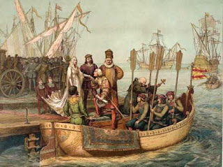

When learning about early Map Making, it should transition into how were those maps used and or expanded into the maps we know today. For that, we will study early explorers to understand why they ventured out to "discover" new lands and how maps were shaped by these voyages.


An explorer will be assigned to each student. The Explorer you are assigned is the explorer with the same number as your current seat.
i.e student sitting at seat 11 gets explorer #11
The directions for the project are listed below


This map is very big, and you should crop out the part of the Map where your Explorer took his voyage(s). Use Google Slides to draw the path(s) from where your Explorer started and where he landed. Be sure to use dates and different colors to depict different voyages (if he, in fact, took more than one voyage)


Resources for the Project
Explorers Name and links to informational websites: ( Link )
Explorers Information website:( Link )  
All about Explorers:( Link )
Notable Explorers: ( Link )
Conquistadors: ( Link )
Mr Donn's Site: (Link)

___________________________________________________________________________________________

Court Cartogropher Project

Each student will play the part of a court cartographer and create a map based on an explorers description.


Due Wednesday/Thursday Night


Sunday, October 21, 2018

Monday & Tuesday Oct 22nd & 23rd Days 43 & 44

Current Events Monday....

will then be followed by...

Mapping and Explorers- Day 3


Objective(s):
1. The advantages of coordinating multiple geographic representations—such as maps, globes, graphs, diagrams, aerial and other photographs, remotely sensed images, and geographic visualizations to answer geographic questions
Therefore, the student is able to:
A. Explain the advantages of using multiple geographic representations to answer geographic questions, as exemplified by being able to
  • Explain how multiple geographic representations and geospatial technologies (e.g., GIS, GPS, RS, and geographic visualization) could be used to solve geographic problems (e.g., help determine where to locate a new playground, or identify dangerous street intersections within a community).
  • Describe how an analysis of urbanization can be done using differ­ent geospatial technologies (e.g., RS for land use, GIS data layers to predict areas of high/low growth, GPS and GIS for identifying trans­portation issues regarding growth).
  • Explain how multiple geospatial technologies can be used to solve land-use problems (e.g., effects of new farming technologies on the sustainable production of food, preservation of wetlands in bird mi­gration flyways).
Rationale: Understanding how maps were created and used allows students to understand the history of exploration and its impact on imperialism.


Evidence: Being able to articulate who pioneered/paid for the trips of explorers will allow students to list and explain the historical significance of maps.
________________________________________________________________________________


History of Map Making presentation

Presentation  - you will have access to a pdf copy of this presentation when it has been presented
________________________________________________________________________________
EXPLORERS PROJECT


When learning about early Map Making, it should transition into how were those maps used and or expanded into the maps we know today. For that, we will study early explorers to understand why they ventured out to "discover" new lands and how maps were shaped by these voyages.


An explorer will be assigned to each student. The Explorer you are assigned is the explorer with the same number as your current seat.
i.e student sitting at seat 11 gets explorer #11
The directions for the project are listed below


This map is very big, and you should crop out the part of the Map where your Explorer took his voyage(s). Use Google Slides to draw the path(s) from where your Explorer started and where he landed. Be sure to use dates and different colors to depict different voyages (if he, in fact, took more than one voyage)


Resources for the Project
Explorers Name and links to informational websites: ( Link )
Explorers Information website:( Link )  
All about Explorers:( Link )
Notable Explorers: ( Link )
Conquistadors: ( Link )
Mr Donn's Site: (Link)

___________________________________________________________________________________________

Court Cartogropher Project

Each student will play the part of a court cartographer and create a map based on an explorers description.

Because of the Rally schedule next week.....
Due Monday/Tuesday Night
Early Map Making Reading Article Question Sheet

Due Wednesday/Thursday Night


Wednesday, October 17, 2018

Thursday & Friday Oct 18th & 19th Days 41 & 42

Mapping and Explorers- Day 2


Objective(s):
1. The advantages of coordinating multiple geographic representations—such as maps, globes, graphs, diagrams, aerial and other photographs, remotely sensed images, and geographic visualizations to answer geographic questions
Therefore, the student is able to:
A. Explain the advantages of using multiple geographic representations to answer geographic questions, as exemplified by being able to
  • Explain how multiple geographic representations and geospatial technologies (e.g., GIS, GPS, RS, and geographic visualization) could be used to solve geographic problems (e.g., help determine where to locate a new playground, or identify dangerous street intersections within a community).
  • Describe how an analysis of urbanization can be done using differ­ent geospatial technologies (e.g., RS for land use, GIS data layers to predict areas of high/low growth, GPS and GIS for identifying trans­portation issues regarding growth).
  • Explain how multiple geospatial technologies can be used to solve land-use problems (e.g., effects of new farming technologies on the sustainable production of food, preservation of wetlands in bird mi­gration flyways).
Rationale: Understanding how maps were created and used allows students to understand the history of exploration and its impact on imperialism.


Evidence: Being able to articulate who pioneered/paid for the trips of explorers will allow students to list and explain the historical significance of maps.
________________________________________________________________________________


History of Map Making presentation

Presentation  - you will have access to a pdf copy of this presentation when it has been presented
________________________________________________________________________________
EXPLORERS PROJECT


When learning about early Map Making, it should transition into how were those maps used and or expanded into the maps we know today. For that, we will study early explorers to understand why they ventured out to "discover" new lands and how maps were shaped by these voyages.


An explorer will be assigned to each student. The Explorer you are assigned is the explorer with the same number as your current seat.
i.e student sitting at seat 11 gets explorer #11
The directions for the project are listed below


This map is very big, and you should crop out the part of the Map where your Explorer took his voyage(s). Use Google Slides to draw the path(s) from where your Explorer started and where he landed. Be sure to use dates and different colors to depict different voyages (if he, in fact, took more than one voyage)


Resources for the Project
Explorers Name and links to informational websites: ( Link )
Explorers Information website:( Link )  
All about Explorers:( Link )
Notable Explorers: ( Link )
Conquistadors: ( Link )
Mr Donn's Site: (Link)

___________________________________________________________________________________________

Court Cartogropher Project

Each student will play the part of a court cartographer and create a map based on an explorers description.


Because of the Rally schedule next week.....
Due (next week) Monday/Tuesday Night
Early Map Making Reading Article Question Sheet

Due (next week) Wednesday/Thursday Night


Tuesday, October 16, 2018

Tuesday& Wednesday Oct 16th & 17th Days 39 & 40

Mapping and Explorers


Objective(s):
1. The advantages of coordinating multiple geographic representations—such as maps, globes, graphs, diagrams, aerial and other photographs, remotely sensed images, and geographic visualizations to answer geographic questions
Therefore, the student is able to:
A. Explain the advantages of using multiple geographic representations to answer geographic questions, as exemplified by being able to
  • Explain how multiple geographic representations and geospatial technologies (e.g., GIS, GPS, RS, and geographic visualization) could be used to solve geographic problems (e.g., help determine where to locate a new playground, or identify dangerous street intersections within a community).
  • Describe how an analysis of urbanization can be done using differ­ent geospatial technologies (e.g., RS for land use, GIS data layers to predict areas of high/low growth, GPS and GIS for identifying trans­portation issues regarding growth).
  • Explain how multiple geospatial technologies can be used to solve land-use problems (e.g., effects of new farming technologies on the sustainable production of food, preservation of wetlands in bird mi­gration flyways).
Rationale: Understanding how maps were created and used allows students to understand the history of exploration and its impact on imperialism.


Evidence: Being able to articulate who pioneered/paid for the trips of explorers will allow students to list and explain the historical significance of maps.
________________________________________________________________________________


History of Map Making presentation

Presentation  - you will have access to a pdf copy of this presentation when it has been presented


________________________________________________________________________________
EXPLORERS PROJECT


When learning about early Map Making, it should transition into how were those maps used and or expanded into the maps we know today. For that, we will study early explorers to understand why they ventured out to "discover" new lands and how maps were shaped by these voyages.


An explorer will be assigned to each student. The Explorer you are assigned is the explorer with the same number as your current seat.
i.e student sitting at seat 11 gets explorer #11
The directions for the project are listed below


This is the World Map you will use on your Explorers project - ( here )
This map is very big, and you should crop out the part of the Map where your Explorer took his voyage(s). Use Google Slides to draw the path(s) from where your Explorer started and where he landed. Be sure to use dates and different colors to depict different voyages (if he, in fact, took more than one voyage)


Explorers Project - Directions Page: ( Link )


Resources for the Project
Explorers Name and links to informational websites: ( Link )
Explorers Information website:( Link )  
All about Explorers:( Link )
Notable Explorers: ( Link )
Conquistadors: ( Link )
Mr Donn's Site: (Link)


When you finish with your Explorer Project submit it into Google Classroom Folder.
Then Start
___________________________________________________________________________________

Assignment due NEXT week Tuesday/Wednesday

Early Map Making Article Summary and Questions- Early Mapmaking Article

Assignment due NEXT week Thursday/Friday


Modern Map Making Article Questions - Here is the Article and questions
Future of  Map Making Article Questions - Here is the Article and questions


Monday, October 15, 2018

Monday Oct 15th Day 38

Current Events/Mapping Monday's

CE #10 & #11

Objective: Given access to a Chromebook, students will be able to access Google MyMaps App and a Google Drive based Current Events Template from the class Blog. Using the MyMaps app and the template, students will be able to look-up current events and summarize their selected story on the template. In addition, students will be able to use the MyMaps app to plot the location of these current event stories. 


Rationale: Students need to utilize the tools taught to them to ensure the learning becomes a part of their skill set. In addition, students need to become geographical aware of the world around them.


Evidence: Filling-in the Current Events template as well as using MyMaps to plot the location of the stories, will demonstrate that students have acquired the basic skills of fulfilling the  assignment.
__________________________________________________________________________________________________________

Thursday, October 11, 2018

Thursday & Friday Oct 11th & 12th Days 36 & 37

For Thursday & Friday Oct 11th & 12th

1st we will finish the Lat/Long Seasons presentation
Latitude & Longitude Video
Seasons Video- Edpuzzle
Time Zones

TimeZone Project

Directions Sheet
Time Zone Form

Student answer forms
Student Form for TimeZone Project
Student List of Cities


Assignments due NEXT week Tuesday/Wednesday

Early Map Making Article Summary and Questions- Early Mapmaking Article

Modern Map Making Article Questions - Here is the Article and questions
Future of  Map Making Article Questions - Here is the Article and questions

Mapping and Explorers


Objective(s):
1. The advantages of coordinating multiple geographic representations—such as maps, globes, graphs, diagrams, aerial and other photographs, remotely sensed images, and geographic visualizations to answer geographic questions
Therefore, the student is able to:
A. Explain the advantages of using multiple geographic representations to answer geographic questions, as exemplified by being able to
  • Explain how multiple geographic representations and geospatial technologies (e.g., GIS, GPS, RS, and geographic visualization) could be used to solve geographic problems (e.g., help determine where to locate a new playground, or identify dangerous street intersections within a community).
  • Describe how an analysis of urbanization can be done using differ­ent geospatial technologies (e.g., RS for land use, GIS data layers to predict areas of high/low growth, GPS and GIS for identifying trans­portation issues regarding growth).
  • Explain how multiple geospatial technologies can be used to solve land-use problems (e.g., effects of new farming technologies on the sustainable production of food, preservation of wetlands in bird mi­gration flyways).
Rationale: Understanding how maps were created and used allows students to understand the history of exploration and its impact on imperialism.


Evidence: Being able to articulate who pioneered/paid for the trips of explorers will allow students to list and explain the historical significance of maps.
________________________________________________________________________________


History of Map Making presentation

Presentation  - you will have access to a pdf copy of this presentation when it has been presented


________________________________________________________________________________
EXPLORERS PROJECT


When learning about early Map Making, it should transition into how were those maps used and or expanded into the maps we know today. For that, we will study early explorers to understand why they ventured out to "discover" new lands and how maps were shaped by these voyages.


An explorer will be assigned to each student.The Explorer you are assigned is the explorer with the same number as your current seat.
i.e student sitting at seat 11 gets explorer #11
The directions for the project are listed below


This is the World Map you will use on your Explorers project - ( here )
This map is very big, and you should crop out the part of the Map where your Explorer took his voyage(s). Use Google Slides to draw the path(s) from where your Explorer started and where he landed. Be sure to use dates and different colors to depict different voyages (if he in fact took more than one voyage)


Explorers Project - Directions Page: ( Link )


Resources for the Project
Explorers Name and links to informational websites: ( Link )
Explorers Information website:( Link )  
All about Explorers:( Link )
Notable Explorers: ( Link )
Conquistadors: ( Link )
Mr Donn's Site: (Link)


When you finish with your Explorer Project submit it into Google Classroom Folder.
Then Start
___________________________________________________________________________________
Modern Map Making Article - ( here )
Future Map Making Article - ( here )


_____________________________________________